
How to Use Google Maps’ New Address Maker App
Google Maps has always been a go-to app for navigation and finding locations, but now it’s taking things a step further with its new Address Maker app. This innovative tool allows users to contribute to the accuracy of Google Maps by adding missing addresses or making corrections to existing ones. In this article, we’ll guide you through how to use this new app and make a positive impact on the accuracy of Google Maps.
To get started, you’ll need to download the Address Maker app from the Google Play Store or the Apple App Store. Once you have it installed on your device, open the app and sign in with your Google account. This will ensure that your contributions are associated with your profile.
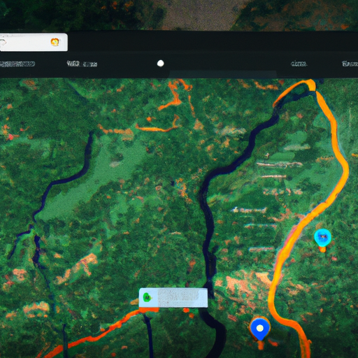
The app’s interface is user-friendly and intuitive. You’ll see a map with a search bar at the top. To add a missing address, simply search for the location where the address is missing. Once you’ve found the correct spot on the map, tap on it to drop a pin. Then, tap on the “Add address” button and enter the necessary details, such as the street name, house number, and any additional information that might be helpful.
If you notice an error in an existing address, you can easily correct it using the app. Search for the location with the incorrect address, drop a pin, and tap on the “Edit address” button. From there, you can make the necessary changes and submit them for review.
It’s important to note that all contributions made through the Address Maker app go through a review process to ensure accuracy. Google has implemented this step to maintain the quality of its mapping data. Once your contribution is reviewed and approved, it will be added to Google Maps, making it accessible to millions of users worldwide.
By using the Address Maker app, you become part of a community of users who are actively improving the accuracy of Google Maps. Your contributions help businesses, emergency services, and individuals find their way more easily. It’s a small effort that can have a big impact.
In addition to the Address Maker app, Google Maps is also offering valuable insights on wildfires and tree coverage. With the increasing threat of wildfires around the world, this feature is particularly relevant. By using satellite imagery and artificial intelligence, Google Maps can now provide up-to-date information on the extent of wildfires and the areas affected.
This information can be crucial for emergency responders and individuals living in affected areas. It allows them to stay informed about the situation and make informed decisions to ensure their safety. Additionally, Google Maps now provides data on tree coverage, which is essential for understanding the environmental impact of deforestation and urbanization.
In conclusion, Google Maps’ new Address Maker app is a powerful tool that allows users to contribute to the accuracy of mapping data. By adding missing addresses or correcting existing ones, you can make a positive impact on the navigation experience for millions of users. Additionally, Google Maps’ insights on wildfires and tree coverage provide valuable information for emergency responders and individuals. So, why not download the Address Maker app today and start making a difference?
Exploring the Features of Google Maps’ Address Maker App
Google Maps has long been a go-to app for navigating our way through unfamiliar streets and finding the best routes to our destinations. But now, the popular mapping service is taking things a step further with its new Address Maker app. This innovative tool allows users to contribute to the accuracy of Google Maps by adding missing addresses or making corrections to existing ones.
The Address Maker app is incredibly user-friendly, making it easy for anyone to participate in improving the accuracy of Google Maps. With just a few taps on your smartphone, you can add a missing address or suggest changes to an existing one. This means that if you come across a new building or a street that is not yet listed on Google Maps, you can now play a part in ensuring that it gets added to the database.
But the Address Maker app is not just about adding missing addresses. It also allows users to suggest corrections to existing addresses. If you notice that a street name is misspelled or that a building number is incorrect, you can simply input the correct information through the app. This way, you can help ensure that Google Maps remains as accurate as possible, benefiting millions of users around the world.
In addition to the Address Maker app, Google Maps is also offering valuable insights on wildfires and tree coverage. With the increasing threat of wildfires in many parts of the world, this feature comes as a welcome addition. By using satellite imagery and machine learning algorithms, Google Maps can now provide up-to-date information on the extent of wildfires and the areas that are at risk.
This information can be crucial for both individuals and authorities in making informed decisions. For example, if you are planning a trip to an area that is prone to wildfires, you can now check Google Maps to see if there are any active fires nearby. This can help you adjust your plans and ensure your safety. Similarly, authorities can use this information to allocate resources and plan evacuation routes more effectively.
But wildfires are not the only environmental concern that Google Maps is addressing. The mapping service is also providing insights on tree coverage. By analyzing satellite imagery, Google Maps can now estimate the density of tree cover in different areas. This information can be useful for urban planners, environmentalists, and researchers who are studying the impact of trees on air quality, temperature regulation, and overall well-being.
With the introduction of the Address Maker app and the insights on wildfires and tree coverage, Google Maps is once again proving its commitment to providing users with the most accurate and up-to-date information. By allowing users to contribute to the accuracy of the app, Google Maps is harnessing the power of crowdsourcing to improve its service. And with the addition of valuable insights on wildfires and tree coverage, Google Maps is becoming an even more indispensable tool for navigating the world around us. So next time you open the app, take a moment to explore these new features and see how you can contribute to making Google Maps even better.
Understanding Google Maps’ Insights on Wildfires
Google Maps has long been a go-to tool for navigating our way through unfamiliar streets, finding the best route to our destination, and even exploring new places from the comfort of our own homes. But did you know that Google Maps also offers valuable insights on wildfires and tree coverage? In this article, we will delve into the fascinating world of Google Maps’ insights on wildfires and how it can help us better understand and prepare for these natural disasters.
Wildfires have become an increasingly common occurrence in many parts of the world, posing a significant threat to both human lives and the environment. With Google Maps’ new address maker app, users can now contribute to the mapping of addresses in areas affected by wildfires. This crowdsourcing approach allows for more accurate and up-to-date information, which is crucial for emergency responders and those living in fire-prone regions.
By using the address maker app, users can mark the locations of their homes, businesses, and other important landmarks on the map. This information helps create a comprehensive database that can be used to assess the risk and impact of wildfires in specific areas. It also enables emergency services to better plan and allocate resources during fire incidents, potentially saving lives and minimizing damage.
But Google Maps’ insights on wildfires go beyond just mapping addresses. The platform also provides valuable data on historical wildfire activity, current fire perimeters, and even real-time updates on active fires. This information is sourced from various authoritative organizations, including government agencies and satellite imagery.
By overlaying this data on the map, users can visualize the extent and severity of wildfires in different regions. This can be particularly useful for those living in or planning to visit areas prone to wildfires. By understanding the historical patterns and current fire perimeters, individuals can make informed decisions about their safety and take necessary precautions.
Furthermore, Google Maps’ insights on wildfires also extend to tree coverage. Trees play a crucial role in mitigating the impact of wildfires by acting as natural firebreaks and reducing the spread of flames. With the help of satellite imagery and advanced algorithms, Google Maps can estimate the density of tree coverage in specific areas.
This information can be invaluable for land management agencies, conservationists, and even homeowners. By identifying areas with low tree coverage, efforts can be made to plant more trees and create green spaces that act as buffers against wildfires. Additionally, homeowners can assess the tree coverage around their properties and take steps to enhance it, such as planting fire-resistant species or creating defensible spaces.
In conclusion, Google Maps’ insights on wildfires offer a wealth of information that can help us better understand and prepare for these natural disasters. From mapping addresses in fire-prone areas to providing real-time updates on active fires, the platform empowers individuals and emergency services alike to make informed decisions and take necessary actions. By leveraging this technology, we can work towards minimizing the impact of wildfires and protecting both lives and the environment. So next time you open Google Maps, take a moment to explore its wildfire insights and contribute to the collective effort of creating a safer world.
The Importance of Tree Coverage: Insights from Google Maps
Google Maps has long been a go-to tool for navigating our way through unfamiliar streets and finding the quickest route to our destinations. But did you know that Google Maps is also a valuable resource for gaining insights into our environment? In a recent update, Google Maps introduced a new Address Maker app that allows users to contribute to the accuracy of map data, including information about tree coverage. This new feature not only empowers users to make a positive impact on their communities but also provides valuable insights into the importance of tree coverage.
Trees play a crucial role in our environment, providing numerous benefits to both humans and the planet. They help combat climate change by absorbing carbon dioxide and releasing oxygen, acting as natural air purifiers. Additionally, trees provide shade, reducing the need for air conditioning and lowering energy consumption. They also help prevent soil erosion and filter water, improving the quality of our water sources. With all these benefits, it’s no wonder that tree coverage is a topic of great interest.
Google Maps’ new Address Maker app allows users to contribute to the accuracy of map data by adding missing addresses or suggesting corrections. But it doesn’t stop there. Users can also provide information about tree coverage in their neighborhoods. By simply marking the location of trees on the map, users can help create a more comprehensive understanding of tree distribution and density. This data can then be used to assess the overall tree coverage in an area and identify areas that may benefit from additional tree planting initiatives.
The insights gained from this new feature are not only fascinating but also incredibly valuable. With the data collected through the Address Maker app, Google Maps can provide insights into the current state of tree coverage in different regions. This information can be used by environmental organizations, urban planners, and policymakers to make informed decisions about tree planting initiatives and urban development. By understanding where tree coverage is lacking, efforts can be focused on areas that need it the most, maximizing the positive impact on the environment and the community.
But the benefits of this new feature don’t stop there. Google Maps also offers insights into the impact of wildfires on tree coverage. Wildfires have become increasingly common and devastating in recent years, causing significant damage to forests and natural habitats. By analyzing satellite imagery and data from past wildfires, Google Maps can provide valuable information about the extent of the damage and the recovery process. This information can help researchers and conservationists better understand the long-term effects of wildfires on tree coverage and develop strategies to mitigate their impact.
In conclusion, Google Maps’ new Address Maker app and its insights into tree coverage are a game-changer for environmental enthusiasts and researchers alike. By allowing users to contribute to map data and mark tree locations, Google Maps empowers individuals to make a positive impact on their communities. The data collected through this app provides valuable insights into the current state of tree coverage and the impact of wildfires. With this information, we can work towards a greener future, maximizing the benefits of trees for both humans and the planet. So next time you use Google Maps, take a moment to appreciate the power of this tool in shaping our understanding of the environment and our role in it.
Enhancing Navigation with Google Maps’ New Features
Google Maps has long been a go-to app for navigation, providing users with accurate directions and real-time traffic updates. But now, the popular mapping service is taking things a step further with the introduction of its new Address Maker app. This innovative tool allows users to contribute to the accuracy of Google Maps by adding missing addresses or suggesting corrections.
With the Address Maker app, users can easily pinpoint locations on the map and provide detailed information about the address, such as the street name, building number, and any additional notes that may be helpful. This crowdsourcing approach not only helps Google Maps stay up to date with the ever-changing landscape of cities and towns but also ensures that users have access to the most accurate and reliable information when navigating.
But Google Maps isn’t just focused on improving navigation. The app is also using its vast database and advanced technology to provide valuable insights on important environmental issues, such as wildfires and tree coverage. By analyzing satellite imagery and other data sources, Google Maps can now provide users with real-time information on the spread of wildfires and the extent of tree coverage in specific areas.
This feature is particularly useful for those living in areas prone to wildfires. By simply opening the Google Maps app, users can see the current boundaries of active fires, helping them make informed decisions about their safety and evacuation plans. Additionally, the app provides information on the air quality in affected areas, allowing users to take necessary precautions to protect their health.
But it’s not just about wildfires. Google Maps also offers insights on tree coverage, which is crucial for understanding the impact of deforestation and climate change. By overlaying satellite imagery with data on tree density, Google Maps can provide users with a visual representation of the amount of tree cover in a particular area. This information can be used by researchers, policymakers, and environmentalists to monitor and address issues related to deforestation and habitat loss.
In addition to these new features, Google Maps continues to enhance its navigation capabilities. The app now offers more detailed and accurate directions, taking into account factors such as road closures, construction, and real-time traffic conditions. This ensures that users can reach their destinations efficiently and without any unnecessary delays.
Furthermore, Google Maps has integrated with other popular apps and services to provide users with a seamless experience. For example, users can now book a ride with Uber or Lyft directly from the Google Maps app, eliminating the need to switch between multiple apps. Similarly, users can find and reserve a table at a restaurant, check the availability of parking spaces, and even order food for delivery, all within the Google Maps app.
With its new Address Maker app, insights on wildfires and tree coverage, and enhanced navigation features, Google Maps is truly revolutionizing the way we navigate and interact with our surroundings. Whether you’re looking for accurate directions, staying informed about environmental issues, or simply exploring new places, Google Maps has got you covered. So, next time you’re planning a trip or need to find your way around, don’t forget to turn to the trusty app that has become an indispensable tool for millions of users worldwide.