The Importance of Tracking Carbon Footprints in the Digital Age
In today’s digital age, where technology plays a significant role in our lives, it is crucial to address the environmental impact of our digital activities. As more and more businesses and individuals rely on cloud computing and data centers, the carbon footprint associated with these operations has become a growing concern. Recognizing this, Google Cloud has introduced two innovative tools: the Carbon Footprint Tracker and the Satellite Imagery Suite, aimed at helping organizations track and reduce their carbon emissions.
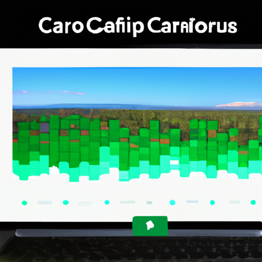
Tracking carbon footprints has become increasingly important as businesses strive to become more sustainable and environmentally conscious. The Carbon Footprint Tracker by Google Cloud provides organizations with a comprehensive view of their carbon emissions across various aspects of their operations. By analyzing data from energy usage, transportation, and other relevant factors, businesses can gain valuable insights into their carbon footprint and identify areas for improvement.
One of the key features of the Carbon Footprint Tracker is its ability to provide real-time data. This allows businesses to monitor their carbon emissions on an ongoing basis and make informed decisions to reduce their environmental impact. With this tool, organizations can set goals, track progress, and implement strategies to achieve their sustainability targets.
In addition to the Carbon Footprint Tracker, Google Cloud’s Satellite Imagery Suite offers a unique perspective on carbon emissions. By leveraging satellite imagery and advanced analytics, this suite enables businesses to visualize and understand the impact of their operations on the environment. It provides detailed insights into deforestation, urbanization, and other factors that contribute to carbon emissions.
The Satellite Imagery Suite also allows organizations to monitor changes in land use and vegetation cover, which are crucial indicators of environmental health. By identifying areas of concern, businesses can take proactive measures to mitigate their impact on the environment. This suite empowers organizations to make data-driven decisions and implement sustainable practices that align with their environmental goals.
The integration of these two tools, the Carbon Footprint Tracker and the Satellite Imagery Suite, offers a comprehensive solution for businesses looking to track and reduce their carbon emissions. By combining real-time data with visual insights, organizations can gain a holistic understanding of their environmental impact and take meaningful steps towards sustainability.
Furthermore, Google Cloud’s commitment to renewable energy further enhances the effectiveness of these tools. With a goal to operate on 24/7 carbon-free energy by 2030, Google Cloud is leading the way in reducing the carbon footprint of its operations. By leveraging renewable energy sources such as wind and solar power, Google Cloud ensures that the data centers supporting these tools are powered by clean energy.
In conclusion, tracking carbon footprints has become a necessity in the digital age, and Google Cloud’s Carbon Footprint Tracker and Satellite Imagery Suite provide valuable tools for organizations to monitor and reduce their environmental impact. By leveraging real-time data and advanced analytics, businesses can gain insights into their carbon emissions and make informed decisions to achieve their sustainability goals. With Google Cloud’s commitment to renewable energy, these tools are not only effective but also contribute to a greener future.
How Google Cloud’s Carbon Footprint Tracker Can Help Businesses Go Green
Google Cloud’s Carbon Footprint Tracker is a groundbreaking tool that can help businesses make a positive impact on the environment. By providing real-time data on carbon emissions, this innovative solution allows companies to track and reduce their carbon footprint effectively. With the increasing focus on sustainability and the urgent need to address climate change, this tool comes at a crucial time.
One of the key benefits of Google Cloud’s Carbon Footprint Tracker is its ability to provide businesses with accurate and up-to-date information on their carbon emissions. By analyzing data from various sources, including energy usage, transportation, and supply chain, this tool offers a comprehensive view of a company’s carbon footprint. This data can then be used to identify areas of improvement and develop strategies to reduce emissions.
The Carbon Footprint Tracker also offers businesses the opportunity to set goals and track their progress over time. By setting targets for emission reduction, companies can actively work towards becoming more sustainable. The tool provides real-time updates on progress, allowing businesses to make informed decisions and adjust their strategies accordingly. This feature not only helps companies stay accountable but also fosters a culture of sustainability within the organization.
In addition to the Carbon Footprint Tracker, Google Cloud’s Satellite Imagery Suite is another powerful tool that can aid businesses in their sustainability efforts. This suite utilizes satellite imagery to provide valuable insights into land use, deforestation, and other environmental factors. By analyzing this data, businesses can gain a better understanding of their impact on the environment and take proactive measures to mitigate it.
For example, the Satellite Imagery Suite can help companies identify areas of deforestation within their supply chain. Armed with this information, businesses can work with their suppliers to implement sustainable practices and ensure that their products are not contributing to deforestation. This not only helps protect valuable ecosystems but also enhances a company’s reputation as a responsible and environmentally conscious organization.
Furthermore, the Satellite Imagery Suite can assist businesses in monitoring the effectiveness of their sustainability initiatives. By comparing satellite images over time, companies can assess the impact of their efforts and make data-driven decisions to further improve their environmental performance. This tool empowers businesses to continuously evaluate and refine their sustainability strategies, ensuring that they are making a meaningful difference.
Google Cloud’s Carbon Footprint Tracker and Satellite Imagery Suite are not only beneficial for individual businesses but also for the planet as a whole. By enabling companies to measure and reduce their carbon emissions, these tools contribute to the global effort to combat climate change. Moreover, by promoting transparency and accountability, they encourage businesses to prioritize sustainability and take meaningful action towards a greener future.
In conclusion, Google Cloud’s Carbon Footprint Tracker and Satellite Imagery Suite are powerful tools that can help businesses go green. By providing real-time data on carbon emissions and valuable insights into environmental factors, these tools enable companies to track their progress, set goals, and make informed decisions to reduce their impact on the environment. With the urgent need to address climate change, these innovative solutions come at a crucial time and offer businesses the opportunity to make a positive impact on the planet.
Exploring the Benefits of Satellite Imagery in Environmental Monitoring
Satellite imagery has revolutionized the way we view and understand our planet. From tracking weather patterns to monitoring deforestation, these images provide valuable insights into the state of our environment. Now, Google Cloud is taking this technology to the next level with their Carbon Footprint Tracker and Satellite Imagery Suite. In this article, we will explore the benefits of satellite imagery in environmental monitoring and how Google Cloud is making a difference.
One of the key advantages of satellite imagery is its ability to provide a comprehensive view of the Earth’s surface. Traditional methods of monitoring the environment often rely on ground-based observations, which can be limited in scope and accuracy. With satellite imagery, we can capture high-resolution images of large areas, allowing us to monitor changes in vegetation, land use, and even air quality.
This wealth of data is particularly valuable in tracking carbon footprints. Carbon emissions are a major contributor to climate change, and understanding their sources and patterns is crucial in developing effective mitigation strategies. Google Cloud’s Carbon Footprint Tracker uses satellite imagery to measure and monitor carbon emissions from various sources, such as power plants and transportation networks. By analyzing these images, we can identify hotspots of carbon emissions and take targeted action to reduce them.
In addition to tracking carbon footprints, satellite imagery also plays a vital role in monitoring deforestation. Forests are essential for maintaining biodiversity and regulating the climate, but they are under constant threat from illegal logging and land conversion. With satellite imagery, we can detect changes in forest cover and identify areas at risk of deforestation. This information is invaluable for conservation efforts and can help authorities take action against illegal activities.
Another area where satellite imagery excels is in disaster management. Natural disasters such as hurricanes, floods, and wildfires can have devastating effects on communities and the environment. By using satellite imagery, we can monitor these events in real-time, providing early warnings and enabling timely response efforts. This technology allows us to assess the extent of damage, identify areas in need of assistance, and plan for future resilience.
Google Cloud’s Satellite Imagery Suite takes these benefits even further by providing a user-friendly platform for accessing and analyzing satellite imagery. This suite includes powerful tools for image processing, data visualization, and machine learning, making it easier for researchers, policymakers, and environmental organizations to harness the full potential of satellite imagery. With this suite, users can explore historical imagery, track changes over time, and gain valuable insights into environmental trends.
In conclusion, satellite imagery has revolutionized environmental monitoring by providing a comprehensive and detailed view of our planet. Google Cloud’s Carbon Footprint Tracker and Satellite Imagery Suite take this technology to new heights, allowing us to track carbon footprints, monitor deforestation, and manage disasters more effectively. With these tools, we can make informed decisions and take targeted action to protect our environment for future generations. So let’s embrace the power of satellite imagery and work together to create a more sustainable and resilient world.
Leveraging Google Cloud’s Satellite Imagery Suite for Sustainable Development
Google Cloud’s Satellite Imagery Suite is not only a powerful tool for businesses and organizations, but it also has the potential to contribute to sustainable development efforts around the world. By leveraging this suite of satellite imagery, users can gain valuable insights into environmental changes, monitor land use, and even track carbon footprints.
One of the key benefits of Google Cloud’s Satellite Imagery Suite is its ability to provide high-resolution images of the Earth’s surface. This allows users to closely monitor changes in land use, such as deforestation or urban expansion. By having access to up-to-date satellite imagery, organizations can make informed decisions about land management and conservation efforts.
In addition to monitoring land use, the Satellite Imagery Suite can also be used to track carbon footprints. With the introduction of Google Cloud’s Carbon Footprint Tracker, businesses can now measure and analyze their greenhouse gas emissions. This tool provides a comprehensive view of a company’s carbon footprint, allowing them to identify areas for improvement and set goals for reducing their environmental impact.
The Carbon Footprint Tracker utilizes satellite imagery to estimate emissions from various sources, such as transportation or energy consumption. By combining this data with other information, such as industry-specific emission factors, businesses can gain a more accurate understanding of their carbon footprint. This knowledge is crucial for developing effective sustainability strategies and meeting climate goals.
Furthermore, the Satellite Imagery Suite can assist in identifying areas that are particularly vulnerable to environmental changes. For example, it can help monitor the impact of climate change on coastal regions, allowing for early detection of rising sea levels or erosion. This information can then be used to develop adaptation plans and protect vulnerable communities.
The suite’s satellite imagery can also be used to support disaster response and recovery efforts. In the aftermath of natural disasters, such as hurricanes or earthquakes, access to accurate and up-to-date information is crucial for coordinating relief efforts. By providing real-time satellite imagery, Google Cloud’s Satellite Imagery Suite can help emergency responders assess the extent of damage, identify areas in need of assistance, and plan effective recovery strategies.
Moreover, the Satellite Imagery Suite is not limited to large organizations or governments. It can be utilized by smaller businesses and non-profit organizations as well. For example, local conservation groups can use the suite to monitor the health of ecosystems and identify areas in need of protection. This democratization of satellite imagery empowers a wide range of stakeholders to contribute to sustainable development efforts.
In conclusion, Google Cloud’s Satellite Imagery Suite is a powerful tool that can be leveraged for sustainable development. By providing high-resolution images of the Earth’s surface, it enables users to monitor land use, track carbon footprints, and identify areas vulnerable to environmental changes. Additionally, it supports disaster response and recovery efforts, and can be utilized by organizations of all sizes. With the introduction of the Carbon Footprint Tracker, businesses can now measure and analyze their greenhouse gas emissions, paving the way for more effective sustainability strategies. By harnessing the potential of Google Cloud’s Satellite Imagery Suite, we can work towards a more sustainable and resilient future.
Case Studies: Real-world Applications of Google Cloud’s Carbon Footprint Tracker and Satellite Imagery Suite
Google Cloud’s Carbon Footprint Tracker and Satellite Imagery Suite have revolutionized the way businesses and organizations can track and reduce their carbon emissions. These powerful tools provide real-time data and insights that enable companies to make informed decisions about their environmental impact. In this article, we will explore some real-world case studies that demonstrate the practical applications of these innovative solutions.
One such case study involves a large multinational corporation that wanted to assess and reduce its carbon footprint across its global operations. By utilizing Google Cloud’s Carbon Footprint Tracker, the company was able to collect and analyze data from various sources, including energy consumption, transportation, and waste management. The tool provided a comprehensive overview of the company’s carbon emissions, allowing them to identify areas of improvement and set ambitious reduction targets.
With the help of the Satellite Imagery Suite, the company was also able to monitor and analyze its supply chain’s environmental impact. By leveraging satellite imagery, they could track deforestation, land use changes, and other activities that contribute to carbon emissions. Armed with this information, the company could make informed decisions about its suppliers and work towards a more sustainable and responsible supply chain.
Another case study involves a renewable energy company that wanted to optimize the placement of its wind farms. By using Google Cloud’s Satellite Imagery Suite, the company could analyze various factors such as wind patterns, terrain, and proximity to transmission lines. This data allowed them to identify the most suitable locations for their wind farms, maximizing energy production while minimizing environmental impact.
In addition to these case studies, Google Cloud’s Carbon Footprint Tracker and Satellite Imagery Suite have also been instrumental in helping cities and governments tackle climate change. For example, a major city wanted to reduce its carbon emissions and improve air quality. By using the Carbon Footprint Tracker, city officials could monitor emissions from various sources such as transportation, buildings, and waste management. This data enabled them to implement targeted policies and initiatives to reduce pollution and create a more sustainable urban environment.
The Satellite Imagery Suite has also been used by governments to monitor and combat deforestation. By analyzing satellite images, authorities can identify areas of illegal logging and take immediate action to protect valuable ecosystems. This technology has proven to be a powerful tool in the fight against deforestation and the preservation of biodiversity.
In conclusion, Google Cloud’s Carbon Footprint Tracker and Satellite Imagery Suite have proven to be invaluable tools in the quest for a more sustainable future. These innovative solutions have enabled businesses, organizations, and governments to track and reduce their carbon emissions, optimize their operations, and make informed decisions about their environmental impact. The real-world case studies highlighted in this article demonstrate the practical applications and positive impact of these powerful tools. With the help of Google Cloud, we can all work towards a greener and more sustainable planet.