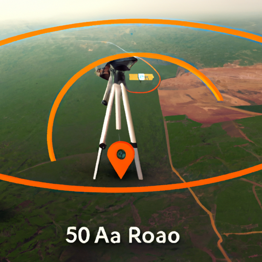
Benefits of ISRO’s collaboration with MapmyIndia for indigenous mapping platform
ISRO, the Indian Space Research Organisation, has recently joined forces with MapmyIndia, a leading Indian mapping and location-based services provider, to create an indigenous mapping platform that aims to challenge the dominance of Google Maps in the country. This collaboration brings together the expertise of ISRO in satellite mapping and navigation technology with MapmyIndia’s extensive database of maps and location-based services. The result is a powerful and accurate mapping platform that offers numerous benefits for both individuals and businesses in India.
One of the key advantages of this collaboration is the enhanced accuracy and detail of the mapping data. By leveraging ISRO’s satellite imagery and navigation technology, the indigenous mapping platform can provide users with highly precise and up-to-date maps. This is particularly important in a country like India, where rapid urbanization and infrastructure development often lead to frequent changes in the landscape. With the new platform, users can rely on accurate maps that reflect the latest changes in roads, buildings, and other landmarks.
Another benefit of the collaboration is the focus on local knowledge and expertise. MapmyIndia has been collecting and curating mapping data in India for over two decades, and their extensive database covers not only major cities but also remote rural areas. By combining this local knowledge with ISRO’s satellite data, the indigenous mapping platform can offer comprehensive coverage of the entire country. This is especially valuable for users in rural areas who may not have access to reliable mapping services. With the new platform, they can navigate their surroundings confidently and efficiently.
Furthermore, the collaboration between ISRO and MapmyIndia promotes the use of indigenous technology and supports the government’s “Make in India” initiative. By developing a mapping platform that is built and operated within the country, India reduces its dependence on foreign mapping services. This not only strengthens the country’s technological capabilities but also ensures data security and sovereignty. With concerns over data privacy and security becoming increasingly important, having a homegrown mapping platform offers peace of mind for users.
The indigenous mapping platform also opens up new opportunities for businesses in India. With accurate and detailed mapping data, businesses can optimize their logistics and delivery operations, saving time and resources. Additionally, the platform can be integrated into various applications and services, such as ride-hailing and food delivery apps, enabling smoother and more efficient user experiences. By leveraging the indigenous mapping platform, businesses can enhance their services and gain a competitive edge in the market.
In conclusion, the collaboration between ISRO and MapmyIndia to create an indigenous mapping platform brings numerous benefits for individuals and businesses in India. The enhanced accuracy and detail of the mapping data, combined with the focus on local knowledge and expertise, provide users with reliable and comprehensive mapping services. Moreover, the platform promotes the use of indigenous technology and supports the government’s “Make in India” initiative. With its potential to optimize logistics and enhance user experiences, the indigenous mapping platform opens up new opportunities for businesses. Overall, this collaboration is a significant step towards challenging the dominance of Google Maps in India and establishing a homegrown mapping platform that meets the unique needs of the country.
How ISRO’s collaboration with MapmyIndia can challenge Google Maps
ISRO, the Indian Space Research Organisation, has recently joined forces with MapmyIndia, a leading Indian mapping and location-based services provider, to develop an indigenous mapping platform that aims to challenge the dominance of Google Maps in the country. This collaboration is a significant step towards promoting self-reliance and technological advancement in India.
Google Maps has long been the go-to mapping service for millions of people around the world. Its user-friendly interface, accurate navigation, and extensive database of locations have made it an indispensable tool for both personal and professional use. However, the reliance on a foreign mapping service raises concerns about data security and privacy. This is where the collaboration between ISRO and MapmyIndia comes into play.
By leveraging ISRO’s expertise in satellite imagery and geospatial technology, and combining it with MapmyIndia’s extensive mapping database, the two organizations aim to create a robust and reliable mapping platform that is tailored specifically for the Indian market. This indigenous platform will not only provide accurate maps and navigation services but also ensure that the data remains within the country, addressing the concerns of data security and privacy.
One of the key advantages of this collaboration is the access to ISRO’s vast repository of satellite imagery. ISRO has been actively involved in satellite launches and remote sensing for several decades, and its satellites have captured high-resolution images of various parts of the country. By integrating this imagery into the mapping platform, users can expect more detailed and up-to-date maps, especially in remote and rural areas where Google Maps may not have comprehensive coverage.
Another significant aspect of this collaboration is the focus on local knowledge and expertise. MapmyIndia has been mapping India for over two decades and has built a strong network of on-ground surveyors who collect data on roads, landmarks, and other points of interest. By combining this local knowledge with ISRO’s satellite imagery, the mapping platform can provide accurate and reliable information that is tailored to the unique needs of the Indian users.
Furthermore, the collaboration aims to develop advanced features that cater specifically to the Indian market. For instance, the platform will include detailed information about local businesses, including their contact details, opening hours, and user reviews. This will not only help users find nearby services more easily but also promote local businesses and boost the Indian economy.
The collaboration between ISRO and MapmyIndia also aligns with the Indian government’s vision of promoting self-reliance and reducing dependence on foreign technologies. By developing an indigenous mapping platform, India can reduce its reliance on foreign mapping services and ensure that critical infrastructure and sensitive locations are not exposed to potential security risks.
In conclusion, the collaboration between ISRO and MapmyIndia has the potential to challenge the dominance of Google Maps in India. By leveraging ISRO’s satellite imagery and geospatial technology, and combining it with MapmyIndia’s extensive mapping database and local expertise, the indigenous mapping platform aims to provide accurate, reliable, and secure mapping services tailored specifically for the Indian market. This collaboration not only promotes self-reliance and technological advancement but also addresses concerns about data security and privacy. With the development of this indigenous mapping platform, India is taking a significant step towards becoming a leader in the field of geospatial technology.
Features and capabilities of the indigenous mapping platform developed by ISRO and MapmyIndia

ISRO, the Indian Space Research Organisation, has joined forces with MapmyIndia to create an indigenous mapping platform that aims to challenge the dominance of Google Maps. This collaboration brings together the expertise of ISRO in satellite mapping and MapmyIndia’s extensive knowledge of the Indian terrain. The result is a powerful mapping platform that offers a range of features and capabilities.
One of the standout features of this indigenous mapping platform is its ability to provide highly accurate and detailed maps of India. By leveraging ISRO’s satellite data, the platform is able to offer up-to-date and comprehensive maps that cover every nook and cranny of the country. This is particularly important in a country as vast and diverse as India, where accurate mapping is crucial for a variety of applications, from navigation to urban planning.
In addition to its accuracy, the indigenous mapping platform also boasts a range of advanced features that set it apart from its competitors. For instance, it offers real-time traffic updates, allowing users to plan their journeys more efficiently and avoid congested routes. This is a game-changer for commuters and travelers alike, as it helps save time and reduce stress on the road.
Another noteworthy feature of the platform is its ability to provide detailed information about points of interest. Whether you’re looking for a restaurant, a hotel, or a tourist attraction, the platform has got you covered. It offers comprehensive information about various establishments, including user reviews, ratings, and even photos. This makes it easier for users to make informed decisions and find the best places to visit or dine at.
Furthermore, the indigenous mapping platform also includes a navigation system that rivals the best in the industry. It offers turn-by-turn directions, voice guidance, and even lane guidance, ensuring that users reach their destinations with ease. This is particularly useful in a country like India, where road conditions and traffic patterns can be unpredictable. With this platform, users can navigate through the chaos and reach their destinations hassle-free.
One of the most exciting aspects of this collaboration between ISRO and MapmyIndia is the potential for future enhancements and innovations. Both organizations are committed to continuously improving the platform and adding new features based on user feedback and evolving technologies. This means that users can expect a constantly evolving and improving mapping experience that caters to their needs and preferences.
In conclusion, the collaboration between ISRO and MapmyIndia has resulted in the development of an indigenous mapping platform that challenges the dominance of Google Maps. With its highly accurate and detailed maps, real-time traffic updates, comprehensive information about points of interest, and advanced navigation system, this platform offers a range of features and capabilities that make it a worthy competitor. Furthermore, the commitment to continuous improvement ensures that users can expect an even better mapping experience in the future. So, whether you’re a commuter, a traveler, or just someone looking for the best places to visit, the indigenous mapping platform developed by ISRO and MapmyIndia is definitely worth checking out.
Implications of ISRO’s collaboration for the Indian mapping and navigation industry
ISRO, the Indian Space Research Organisation, has recently joined forces with MapmyIndia, a leading Indian mapping and location-based services provider, to develop an indigenous mapping platform. This collaboration aims to challenge the dominance of Google Maps in the Indian mapping and navigation industry. The implications of this partnership are significant and could have far-reaching effects on various sectors.
One of the key implications of this collaboration is the boost it will provide to the Indian mapping and navigation industry. With Google Maps currently holding a monopoly in this space, the entry of an indigenous platform backed by ISRO’s expertise is a game-changer. This move will not only promote healthy competition but also encourage innovation and technological advancements in the field.
Furthermore, this collaboration has the potential to enhance the accuracy and reliability of mapping and navigation services in India. By leveraging ISRO’s satellite imagery and MapmyIndia’s extensive mapping database, the new platform can offer more precise and up-to-date information. This will be particularly beneficial for sectors such as transportation, logistics, and emergency services, where accurate mapping data is crucial for efficient operations.
Another implication of this partnership is the positive impact it can have on data privacy and security. With concerns over data sharing and privacy becoming increasingly prevalent, an indigenous mapping platform can provide reassurance to users. By keeping the data within the country and under the control of Indian authorities, the platform can ensure better protection of sensitive information.
Moreover, this collaboration has the potential to boost the Indian economy. With an indigenous mapping platform, businesses can rely on local services rather than depending on foreign counterparts. This will not only create job opportunities but also contribute to the growth of the Indian technology sector. Additionally, the availability of accurate mapping data can attract more investments and facilitate the development of smart cities and infrastructure projects.
The collaboration between ISRO and MapmyIndia also holds promise for rural development. With a focus on indigenous mapping, the platform can provide better coverage and accessibility to remote areas. This can be particularly beneficial for farmers, who can leverage the platform to access information on weather patterns, soil quality, and crop planning. By empowering rural communities with reliable mapping and navigation services, this collaboration can bridge the digital divide and promote inclusive growth.
In conclusion, the collaboration between ISRO and MapmyIndia to challenge Google Maps with an indigenous mapping platform has significant implications for the Indian mapping and navigation industry. It not only promotes healthy competition but also enhances accuracy, data privacy, and security. Furthermore, it has the potential to boost the Indian economy, facilitate rural development, and drive innovation in the technology sector. With this partnership, India is taking a bold step towards self-reliance in the mapping and navigation space, and the benefits are likely to be felt across various sectors.
Future prospects and potential impact of ISRO’s indigenous mapping platform on global mapping services
ISRO, the Indian Space Research Organisation, has recently joined forces with MapmyIndia, a leading Indian mapping and location-based services provider, to develop an indigenous mapping platform. This collaboration aims to challenge the dominance of Google Maps in the global mapping services market. With the combined expertise of ISRO and MapmyIndia, this new platform has the potential to revolutionize the way we navigate and explore the world.
One of the key advantages of this indigenous mapping platform is its reliance on Indian satellite data. ISRO, known for its remarkable achievements in space exploration, has a fleet of satellites that provide high-resolution imagery and accurate geospatial data. By leveraging this vast satellite network, the new mapping platform can offer more detailed and up-to-date maps of India and other regions.
This collaboration is a significant step towards reducing India’s dependence on foreign mapping services. Currently, Google Maps dominates the global market, including India, where it is the go-to navigation tool for millions of users. However, this reliance on foreign technology raises concerns about data security and privacy. With an indigenous mapping platform, India can have greater control over its mapping data, ensuring the protection of sensitive information.
Moreover, the collaboration between ISRO and MapmyIndia has the potential to boost the Indian economy. By developing a homegrown mapping platform, India can tap into the growing market for location-based services. This platform can serve as a foundation for various applications, such as transportation, logistics, urban planning, and tourism. By nurturing a thriving ecosystem of developers and entrepreneurs, this collaboration can create job opportunities and drive innovation in the Indian tech industry.
The impact of this indigenous mapping platform extends beyond India’s borders. With its high-resolution satellite imagery and accurate geospatial data, this platform can contribute to global mapping services. It can provide valuable insights for disaster management, environmental monitoring, and infrastructure development in various countries. By sharing its expertise and resources, India can become a key player in the global mapping industry.
Furthermore, this collaboration aligns with the Indian government’s vision of a self-reliant and digitally empowered nation. By developing indigenous technologies, India aims to reduce its dependence on foreign imports and strengthen its technological capabilities. The indigenous mapping platform is a testament to India’s commitment to innovation and self-sufficiency.
However, challenging the dominance of Google Maps will not be an easy task. Google has established itself as the leader in mapping services, with a vast user base and a wealth of data. To compete effectively, the indigenous mapping platform needs to offer unique features and a seamless user experience. It should also focus on addressing the specific needs of Indian users, such as accurate navigation in rural areas and support for multiple regional languages.
In conclusion, the collaboration between ISRO and MapmyIndia to develop an indigenous mapping platform has the potential to disrupt the global mapping services market. By leveraging ISRO’s satellite network and MapmyIndia’s expertise, this platform can offer more detailed and up-to-date maps of India and other regions. It can also contribute to India’s economic growth and position the country as a key player in the global mapping industry. While challenging the dominance of Google Maps will be a formidable task, this collaboration represents a significant step towards a self-reliant and digitally empowered India.