Exploring Google Photos’ New Feature: Maps Timeline for Trip Photos
Google Photos has always been a popular choice for users to store and organize their photos. With its user-friendly interface and unlimited storage, it has become a go-to app for many. Now, Google Photos has introduced a new feature called Maps Timeline, which allows users to display their trip photos by route. This exciting addition takes the photo organizing experience to a whole new level.
Maps Timeline is a feature that leverages the power of Google Maps to create a visual representation of your trips. It uses the location data from your photos to plot them on a map, giving you a chronological view of your journey. This means that you can now relive your travel adventures in a more immersive and interactive way.
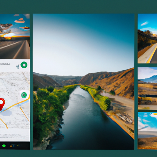
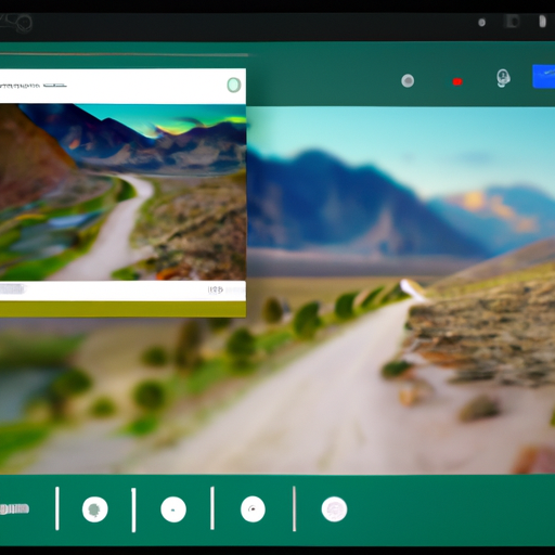
To access Maps Timeline, simply open the Google Photos app and tap on the “Search” tab at the bottom of the screen. From there, you will see a new option called “Your Map.” Tapping on it will take you to a map view where you can explore your photos based on the places you’ve been.
One of the most exciting aspects of Maps Timeline is the ability to see your trip photos along the route you took. As you scroll through the map, you will notice that your photos are grouped together based on the locations they were taken. This allows you to easily navigate through your journey and reminisce about the places you visited.
Not only does Maps Timeline display your photos on a map, but it also provides additional information about each location. When you tap on a photo cluster, you will see a preview of the photos taken at that specific place. You can then tap on individual photos to view them in full size and read any captions or comments you may have added.
Maps Timeline also offers a handy feature called “Explore.” By tapping on the magnifying glass icon at the top right corner of the map view, you can search for specific places or categories, such as restaurants, landmarks, or parks. This makes it easy to find photos from a particular location or discover new places you may have missed during your trip.
Another great feature of Maps Timeline is the ability to share your trip photos with others. You can create a customized album of your journey and share it with friends and family. They can then explore your photos on the map and experience your trip alongside you.
Maps Timeline is not only a great tool for reliving your past adventures but also for planning future ones. By looking at your previous trips, you can get inspiration for new destinations or revisit places you loved. It’s like having a personal travel journal that you can access anytime, anywhere.
In conclusion, Google Photos’ new feature, Maps Timeline, takes photo organization to a whole new level. With its ability to display trip photos by route, it allows users to relive their travel adventures in an immersive and interactive way. The additional features, such as location information and the ability to explore and share photos, make Maps Timeline a valuable tool for both reminiscing and planning future trips. So, if you’re a travel enthusiast or simply love capturing memories, give Maps Timeline a try and let your photos take you on a journey.
How to Use Google Photos’ Maps Timeline to Relive Your Travel Adventures
Google Photos has always been a handy tool for organizing and storing our precious memories. With its unlimited storage capacity and powerful search capabilities, it has become a go-to app for many users. But now, Google Photos has taken it a step further by introducing Maps Timeline, a feature that allows you to relive your travel adventures in a whole new way.
Maps Timeline is a feature that displays your trip photos on a map, allowing you to see exactly where each photo was taken. It creates a visual representation of your journey, making it easy to reminisce about the places you’ve been and the experiences you’ve had. Whether you’re a frequent traveler or just enjoy the occasional vacation, Maps Timeline is a fantastic tool for reliving your travel adventures.
To use Maps Timeline, you’ll need to have Google Photos installed on your device and have location services enabled. Once you have these prerequisites in place, you can start exploring your travel memories. Simply open the Google Photos app and tap on the “Search” tab at the bottom of the screen. From there, you’ll see a section labeled “Your Map” – this is where the magic happens.
When you tap on “Your Map,” you’ll be taken to a map view that displays all the places you’ve visited. Each location is marked with a pin, and when you tap on a pin, you’ll see a collection of photos taken in that area. It’s like having a virtual travel album that takes you on a journey through your past adventures.
But Maps Timeline doesn’t stop there. It also allows you to view your photos by route, giving you a chronological display of your trip. This feature is particularly useful if you want to relive a specific journey or if you’re trying to remember the order in which you visited different places. By following the route on the map, you can easily navigate through your photos and immerse yourself in the memories.
In addition to reliving your travel adventures, Maps Timeline also offers some practical benefits. For example, if you’re planning a trip to a new destination, you can use Maps Timeline to see photos taken by others in that area. This can give you a better idea of what to expect and help you plan your itinerary. You can also use the feature to share your travel experiences with friends and family. By simply sending them a link to your Maps Timeline, they can explore your journey and feel like they’re right there with you.
Google Photos’ Maps Timeline is a fantastic tool for reliving your travel adventures. It allows you to see your trip photos on a map, giving you a visual representation of your journey. Whether you want to reminisce about past adventures or plan future ones, Maps Timeline is a must-have feature for any travel enthusiast. So, next time you’re feeling nostalgic or planning your next trip, open up Google Photos and let Maps Timeline take you on a virtual journey through your travel memories.
Enhancing Your Travel Memories with Google Photos’ Maps Timeline
Google Photos has always been a popular choice for storing and organizing our precious memories. With its unlimited storage and powerful search capabilities, it has become an essential tool for many of us. But now, Google Photos is taking it a step further by introducing Maps Timeline, a feature that allows you to display your trip photos by route. This new addition is set to enhance your travel memories and make them even more special.
So, how does Maps Timeline work? Well, it’s quite simple. When you enable this feature, Google Photos will automatically organize your photos based on the locations they were taken. It will then create a timeline of your trip, showing you the route you took and the photos you captured along the way. This means that you can now relive your travel adventures in a whole new way.
Imagine being able to see your entire journey on a map, with each photo pinpointed at the exact location it was taken. It’s like having a virtual travel diary that you can easily access and share with others. Whether you’re reminiscing about a recent vacation or planning your next adventure, Maps Timeline will bring your travel memories to life.
But that’s not all. Google Photos’ Maps Timeline also allows you to add captions and notes to your photos, making them even more meaningful. You can include details about the places you visited, the people you met, or any interesting stories that happened along the way. This way, you can create a personalized travel journal that tells the story of your trip.
Another great feature of Maps Timeline is the ability to create and share albums based on your routes. Let’s say you took a road trip along the California coast and captured some stunning photos of the scenic views. With just a few clicks, you can create an album that showcases these photos and share it with your friends and family. It’s a fantastic way to relive your journey and share your experiences with others.
Maps Timeline also offers a convenient way to search for specific photos from your trips. If you’re looking for a particular photo from a specific location, you can simply search for it using keywords or the name of the place. Google Photos will then display all the photos taken at that location, making it easy to find what you’re looking for.
In addition to all these exciting features, Maps Timeline also provides a sense of nostalgia and nostalgia. It’s a reminder of the places you’ve been, the people you’ve met, and the experiences you’ve had. It’s a way to relive those precious moments and cherish them forever.
So, if you’re a travel enthusiast or simply someone who loves capturing memories, Google Photos’ Maps Timeline is a must-try feature. It will take your travel memories to the next level and make them even more special. Give it a go and let your travel adventures come to life on the map.
A Closer Look at Google Photos’ Maps Timeline: An Innovative Way to Showcase Your Trips
Google Photos has always been a popular choice for users to store and organize their photos. With its user-friendly interface and unlimited storage, it has become a go-to app for many. But now, Google Photos has taken it a step further by introducing Maps Timeline, an innovative feature that allows users to display their trip photos by route. This new addition is a game-changer for travel enthusiasts and anyone who loves to document their adventures.
So, what exactly is Maps Timeline? It is a feature that uses location data from your photos to create a visual representation of your trips on a map. It allows you to see where you’ve been and the photos you took along the way. This is not only a great way to reminisce about your past travels but also a fantastic tool for planning future trips.
The Maps Timeline feature is incredibly easy to use. All you need to do is open the Google Photos app, tap on the search bar, and select the “Places” tab. From there, you can choose a specific location or scroll through your timeline to see all the places you’ve been. Each location is marked on the map, and when you tap on it, you can view all the photos you took at that particular spot.
One of the most exciting aspects of Maps Timeline is the ability to see your trip photos displayed along the route you took. This feature adds a whole new dimension to reliving your travel experiences. Instead of just seeing individual photos, you can now visualize your entire journey and the different places you visited. It’s like taking a virtual tour of your trip!
Imagine being able to show your friends and family the exact route you took on your last vacation, complete with all the stunning photos you captured along the way. It’s a fantastic way to share your adventures and bring your travel stories to life. Plus, it’s a great conversation starter and can inspire others to embark on their own journeys.
Maps Timeline also offers some practical benefits. For instance, if you’re planning a trip to a new destination, you can use this feature to explore the places you want to visit beforehand. By looking at the photos taken by others along the same route, you can get a better idea of what to expect and what spots are worth checking out. It’s like having a personal travel guide at your fingertips.
Additionally, Maps Timeline can help you organize your photos more efficiently. Instead of scrolling through hundreds or even thousands of pictures to find the ones from a specific trip, you can simply go to the Maps Timeline and locate them based on the location. This saves you time and makes it easier to create albums or share your photos with others.
In conclusion, Google Photos’ Maps Timeline is a fantastic addition to an already impressive app. It offers a unique and innovative way to showcase your trips, allowing you to see your photos displayed along the route you took. Whether you’re reminiscing about past adventures or planning future ones, this feature is a must-try for any travel enthusiast. So, go ahead, open up Google Photos, and take a trip down memory lane with Maps Timeline!
Unveiling Google Photos’ Maps Timeline: The Ultimate Tool for Organizing and Sharing Your Travel Photos
Google Photos has long been a popular choice for organizing and storing our precious memories. With its unlimited storage and powerful search capabilities, it has become an essential tool for many. But now, Google Photos is taking things to the next level with the introduction of Maps Timeline, a feature that allows you to display your trip photos by route. This new addition is set to revolutionize the way we organize and share our travel photos.
So, what exactly is Maps Timeline? Well, it’s a feature that uses the location data from your photos to create a visual representation of your journey on a map. It allows you to see where you’ve been and the photos you took along the way. This is incredibly useful for those of us who love to document our travels and want an easy way to relive those memories.
To access Maps Timeline, all you need to do is open Google Photos and tap on the “Search” tab at the bottom of the screen. From there, you’ll see a new option called “Your Map.” Once you tap on it, you’ll be taken to a map that displays your photos based on the locations they were taken. You can zoom in and out, scroll around, and explore your journey in a way that feels almost like you’re reliving it.
But Maps Timeline isn’t just about reliving your memories; it’s also a fantastic tool for organizing your travel photos. With the ability to see your photos by route, you can easily group them together and create albums based on specific trips or locations. This makes it much easier to find and share your photos with friends and family.
Imagine you took a road trip along the California coast last summer. With Maps Timeline, you can now see all the photos you took along that route, from the iconic Golden Gate Bridge to the stunning Big Sur coastline. You can then create an album specifically for that trip and share it with your loved ones, allowing them to experience your journey through your eyes.
But the benefits of Maps Timeline don’t stop there. It’s also a great tool for planning future trips. By looking at your past journeys, you can get inspiration for new destinations and routes to explore. You can see the places you loved and the ones you missed, helping you create the perfect itinerary for your next adventure.
Additionally, Maps Timeline can be a valuable resource for those who love to blog or write about their travels. With the ability to see your photos by route, you can easily reference specific locations and moments in your writing. This adds a whole new level of depth and authenticity to your travel stories, making them even more engaging for your readers.
In conclusion, Google Photos’ Maps Timeline is a game-changer for travel enthusiasts and photographers alike. It allows us to organize and share our travel photos in a way that is both visually stunning and incredibly practical. Whether you’re reliving past adventures, planning future trips, or documenting your travels for others to enjoy, Maps Timeline is the ultimate tool for organizing and sharing your travel photos. So, go ahead, open Google Photos, and embark on a journey through your memories like never before.