Benefits of Using Google Maps’ Real-Time Bus Information Service in Delhi
Google Maps’ Real-Time Bus Information Service in Delhi is a game-changer for commuters in the bustling city. With this service, users can easily track the location and arrival time of buses in real-time, making their daily commute more efficient and stress-free. In this article, we will explore the benefits of using Google Maps’ Real-Time Bus Information Service in Delhi and how it can enhance your travel experience.
One of the key advantages of this service is the ability to plan your journey more effectively. Gone are the days of waiting at the bus stop, unsure of when your bus will arrive. With Google Maps’ Real-Time Bus Information Service, you can check the estimated arrival time of your bus and plan your departure accordingly. This feature is particularly useful during rush hours when buses tend to be crowded, and every minute counts.
Another benefit of using this service is the convenience it offers. Instead of relying on traditional bus schedules, which may not always be accurate, you can rely on real-time data provided by Google Maps. This means that you can avoid unnecessary waiting time and plan your day more efficiently. Whether you are heading to work, meeting friends, or running errands, knowing the exact arrival time of your bus can save you valuable time.
Furthermore, Google Maps’ Real-Time Bus Information Service provides users with a sense of security. By knowing the location of your bus at any given time, you can feel more at ease while waiting at the bus stop. This is especially important for those traveling alone or during late hours. With this service, you can track your bus’s progress and have peace of mind knowing that help is just a few minutes away.
In addition to these benefits, Google Maps’ Real-Time Bus Information Service also promotes sustainability. By providing users with accurate information about bus arrival times, it encourages more people to opt for public transportation instead of private vehicles. This, in turn, reduces traffic congestion and air pollution in the city. By using this service, you are not only making your own commute easier but also contributing to a greener and more sustainable Delhi.
Lastly, Google Maps’ Real-Time Bus Information Service is incredibly user-friendly. The interface is intuitive and easy to navigate, making it accessible to people of all ages and technological backgrounds. Whether you are a tech-savvy individual or someone who is new to using smartphone applications, you will find this service simple and straightforward to use. With just a few taps on your screen, you can access all the information you need to make your bus journey smoother.
In conclusion, Google Maps’ Real-Time Bus Information Service in Delhi offers numerous benefits to commuters. From effective journey planning to increased convenience and security, this service has revolutionized the way people travel in the city. By using this service, you can save time, reduce stress, and contribute to a more sustainable environment. So, the next time you plan to take a bus in Delhi, make sure to utilize Google Maps’ Real-Time Bus Information Service for a hassle-free and enjoyable commute.
Step-by-Step Guide: How to Access Real-Time Bus Information on Google Maps in Delhi
Google Maps has become an indispensable tool for navigating through the bustling streets of Delhi. With its detailed maps, turn-by-turn directions, and real-time traffic updates, it has made getting around the city a breeze. But did you know that Google Maps also offers a real-time bus information service? This feature allows you to track the location of buses in Delhi, helping you plan your journey more efficiently. In this step-by-step guide, we will show you how to access this service and make the most of it.
Firstly, make sure you have the latest version of the Google Maps app installed on your smartphone. Open the app and enter your destination in the search bar. Once you have selected your destination, tap on the “Directions” button. This will bring up a list of available transportation options, including buses.
Next, select the bus icon from the list of transportation options. Google Maps will then display a list of bus routes that can take you to your destination. Each bus route will have a number and a name, making it easy for you to identify the right one. Tap on the bus route that you want to take.
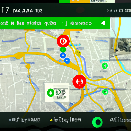
After selecting the bus route, Google Maps will show you the estimated time of arrival for the next bus. This is based on real-time data provided by the Delhi Transport Corporation (DTC). You can also see the current location of the bus on the map, marked by a moving icon. This allows you to track the bus in real-time and plan your journey accordingly.
To get more detailed information about the bus, such as the number of stops and the estimated time of arrival at each stop, tap on the bus icon on the map. This will bring up a pop-up window with all the relevant information. You can also see the bus’s route highlighted on the map, making it easier for you to visualize the journey.
If you want to save a particular bus route for future reference, you can add it to your favorites. Simply tap on the star icon next to the bus route, and it will be saved under the “Your Places” section in the Google Maps app. This way, you can easily access the bus route whenever you need it, without having to search for it again.
In addition to tracking buses in real-time, Google Maps also provides alerts for delays and disruptions. If there is a change in the bus schedule or any other issue that may affect your journey, you will receive a notification on your smartphone. This ensures that you are always up to date with the latest information and can plan your travel accordingly.
Using Google Maps’ real-time bus information service in Delhi is a game-changer for commuters. It not only saves time but also reduces the stress of waiting for buses that may be delayed or overcrowded. With this step-by-step guide, you can easily access this service and make your daily commute a smoother experience. So, the next time you need to catch a bus in Delhi, don’t forget to turn to Google Maps for real-time updates and hassle-free travel.
Tips and Tricks for Efficiently Navigating Delhi’s Bus Routes with Google Maps
Delhi, the bustling capital city of India, is known for its vibrant culture, historical landmarks, and chaotic traffic. Navigating the city’s extensive bus network can be a daunting task, especially for newcomers or tourists. However, with the help of Google Maps’ real-time bus information service, getting around Delhi has become much easier and more efficient.
Google Maps has revolutionized the way we navigate cities, and Delhi is no exception. With its real-time bus information service, you can now track the exact location of buses, check their arrival times, and plan your journey accordingly. This service is a game-changer for anyone who relies on public transportation in Delhi.
To use Google Maps’ real-time bus information service, all you need is a smartphone with an internet connection. Simply open the Google Maps app and enter your destination. Then, tap on the “Directions” button and select the public transportation option. Google Maps will show you a list of available bus routes, along with their estimated arrival times.
Once you’ve selected a bus route, Google Maps will display the bus stops along the way. You can track the location of the bus in real-time, so you’ll know exactly when it will arrive at your stop. This feature is particularly useful if you’re running late or want to avoid waiting at the bus stop for too long.
In addition to real-time bus tracking, Google Maps also provides other useful information about Delhi’s bus routes. You can see the bus numbers, the frequency of service, and even the estimated travel time for each route. This allows you to plan your journey more efficiently and choose the most convenient bus route for your destination.
Another handy feature of Google Maps’ real-time bus information service is the ability to set reminders for your bus journey. If you’re worried about missing your stop, you can set a reminder to alert you when your stop is approaching. This ensures that you never miss your destination, even if you’re engrossed in a book or a conversation.
Google Maps’ real-time bus information service is constantly updated with the latest data from Delhi’s bus operators. This means that you can rely on the information provided by Google Maps to plan your journey accurately. However, it’s always a good idea to double-check the information with the bus operator or fellow passengers, as unexpected delays or changes in routes can occur.
In conclusion, Google Maps’ real-time bus information service is a valuable tool for efficiently navigating Delhi’s bus routes. With its ability to track buses in real-time, provide estimated arrival times, and offer other useful information, Google Maps has made traveling by bus in Delhi much easier and more convenient. So, the next time you need to get around the city, don’t forget to use Google Maps to plan your journey and make your bus ride a breeze.
Exploring Delhi’s Neighborhoods: Using Google Maps’ Real-Time Bus Information Service
Are you planning to explore the vibrant neighborhoods of Delhi? Navigating through the city’s bustling streets can be quite a challenge, especially if you’re unfamiliar with the local transportation system. But fear not! Google Maps’ real-time bus information service is here to make your journey a breeze.
Delhi, the capital city of India, is known for its rich history, diverse culture, and bustling markets. From the narrow lanes of Old Delhi to the modern skyscrapers of New Delhi, there’s something for everyone to explore. And what better way to immerse yourself in the local experience than by using public transportation?
Google Maps’ real-time bus information service provides up-to-date information on bus routes, schedules, and estimated arrival times. It’s a handy tool that can help you plan your journey, avoid unnecessary waiting, and make the most of your time in Delhi.
To get started, simply open the Google Maps app on your smartphone and enter your destination. Then, tap on the public transportation icon, which looks like a bus. This will bring up a list of available bus routes that can take you to your destination.
Once you’ve selected a bus route, Google Maps will display the estimated arrival time of the next bus at your current location. This real-time information is incredibly useful, as it allows you to plan your journey accordingly. You can see how long you have to wait for the bus and adjust your schedule accordingly.
But that’s not all! Google Maps also provides detailed information about each bus stop along the route. You can see the names of the stops, the distance between them, and even the landmarks nearby. This can be particularly helpful if you’re unfamiliar with the area and need to navigate your way around.
If you’re not sure which bus stop is closest to your current location, Google Maps can help with that too. Simply enable your device’s location services, and the app will automatically detect your current location. It will then show you the nearest bus stops and the routes that pass through them.
Once you’re on the bus, Google Maps can continue to be your trusty companion. The app will track your journey in real-time, showing you the upcoming stops and the distance remaining to your destination. This can be especially helpful if you’re traveling to a new neighborhood and want to make sure you don’t miss your stop.
In addition to real-time bus information, Google Maps also provides alternative transportation options. If there are no buses available or if you prefer a different mode of transport, you can easily switch to walking, cycling, or even ride-sharing services like Uber or Ola. This flexibility allows you to choose the option that best suits your needs and preferences.
So, the next time you’re planning to explore Delhi’s neighborhoods, don’t forget to take advantage of Google Maps’ real-time bus information service. It’s a reliable and user-friendly tool that can help you navigate the city’s public transportation system with ease. Whether you’re a local or a tourist, this service is sure to enhance your Delhi experience. Happy exploring!
Enhancing Your Commute: Making the Most of Google Maps’ Real-Time Bus Information in Delhi
Are you tired of waiting at the bus stop, unsure of when your bus will arrive? Do you wish there was a way to track your bus in real-time, so you can plan your commute more efficiently? Well, look no further! Google Maps’ real-time bus information service is here to save the day, making your daily commute in Delhi a breeze.
First things first, you’ll need to have the Google Maps app installed on your smartphone. If you don’t have it yet, head over to your app store and download it. Once you have the app, open it up and type in your destination. Google Maps will show you various transportation options, including buses. Select the bus icon, and you’re on your way to accessing real-time bus information.
Now that you’ve selected the bus option, Google Maps will display a list of available bus routes that can take you to your destination. Each route will have a number and a name, making it easy for you to identify the right bus. Once you’ve chosen your desired route, tap on it to see the bus stops along the way.
Here comes the exciting part – real-time bus information! Google Maps will show you the location of the buses on your selected route, indicated by small bus icons moving along the map. You can now see exactly where your bus is and how far away it is from your location. No more guessing games or anxiously waiting at the bus stop!
But wait, there’s more! Google Maps also provides estimated arrival times for each bus at every stop. This feature allows you to plan your commute more effectively, knowing exactly when your bus will arrive. You can even set reminders to alert you when it’s time to leave your current location, ensuring you never miss your bus again.
In addition to real-time bus information, Google Maps also offers other useful features to enhance your commute. For example, you can view the bus route in detail, including all the stops along the way. This can be particularly helpful if you’re new to the city or unfamiliar with a certain area. You can also access information about the bus service, such as its frequency and any special instructions or announcements.
Furthermore, Google Maps allows you to customize your preferences for bus routes. If you have a preferred bus company or want to avoid certain routes, you can easily adjust your settings accordingly. This way, you can tailor your commute to your specific needs and preferences.
In conclusion, Google Maps’ real-time bus information service is a game-changer for commuters in Delhi. With the ability to track buses in real-time, view estimated arrival times, and access detailed route information, your daily commute will become more efficient and stress-free. So, next time you’re heading out, don’t forget to open up Google Maps and make the most of this incredible tool. Happy commuting!